Contents12 sections
This guide was first published in German on handgetestet.de.
No warning in the app doesn’t by any means mean you’re cleared for takeoff. Only the Map Tool of dipul, the Digital Platform for Unmanned Aviation of the German Federal Ministry of Transport, reliably shows whether you’re allowed to fly at a given location. It displays the geozones of the German Air Traffic Regulations exactly as lawmakers intend them. Apps such as Droniq TraX make looking at the map on your phone more convenient, and DJI Fly warns you during flight. Neither replaces a permit.
We laid the most widely used maps and apps side by side: where the data comes from, what they cost, how they handle and where they stop. Our basis is the information from the providers, the authorities and the legal text, as of November 2026. At the very bottom you’ll find a small selection of drones with their EU class, because the class helps determine which distances apply to you.
Rules first, then the map
In the EU, private camera drones almost always fly in the open category of Implementing Regulation (EU) 2019/947. Our guide Buying a drone (in German) explains the details of weight classes and labeling. For the question of where, a few key points are enough.
- A maximum of 120 meters above ground, in every class.
- Registration with the German Federal Aviation Office (Luftfahrt-Bundesamt, LBA) as soon as the drone weighs more than 249 grams or carries a camera. You receive an e-ID that goes on each of your drones.
- From 250 grams takeoff mass, you must hold the EU A1/A3 proof of competency before your first flight, an online course with an exam at the LBA. If you want to fly a C2 drone close to people, you also need the A2 remote pilot certificate.
- In subcategory A3, a distance of at least 150 meters from residential, commercial, industrial and recreational areas applies.
- Liability insurance is mandatory, and you should carry the confirmation with you on every flight. The minimum age is 16, with exceptions for toys and for supervised flights.
Then comes the German chapter. In principle, use of the airspace is free. However, Section 21h of the German Air Traffic Regulations (Luftverkehrs-Ordnung, LuftVO) lists the geographical zones in which you may only fly under certain conditions. These are exactly the zones a good map shows:
- Airports: 1,000 meters around the site and along the runway centerlines, each extended by 5 kilometers. This is only permitted in the specific category, so not for hobby pilots.
- Other airfields: 1.5 kilometers, and only with the consent of the aviation supervisory authority, the flight control or the operator.
- Control zones only with air traffic control clearance. More on that in a moment.
- 100 meters from industrial facilities, power plants, substations, prisons, military installations, government agencies, police and hospitals, unless the responsible body or the operator expressly agrees.
- Autobahns, federal highways, federal waterways and railway facilities: also 100 meters. You may get closer if your flight altitude always remains lower than the lateral distance and that distance is more than 10 meters. In the open category, you may only fly over roads and tracks with the consent of the responsible body. You may cross a federal waterway by the shortest route at an altitude of at least 100 meters, as long as you don’t fly over ships or locks.
- Nature reserves and national parks: for recreational flights only with the consent of the nature conservation authority, unless state law provides otherwise.
- Residential properties: with a camera drone only if the owners or residents agree. The exception from 100 meters altitude requires a legitimate purpose and further conditions; it doesn’t cover a vacation video.
- Outdoor pools and swimming beaches only outside bathing and opening hours; accident and emergency sites only with the consent of the incident commander.
If you need to fly into one of these zones, you apply for an exemption under Section 21i LuftVO to the state aviation authority of the German state where you take off. Some states have issued general rulings, Bavaria for example for railway facilities and airports. dipul maintains the list of responsible bodies along with their forms.
Control zones: easier since August 2026, but not open
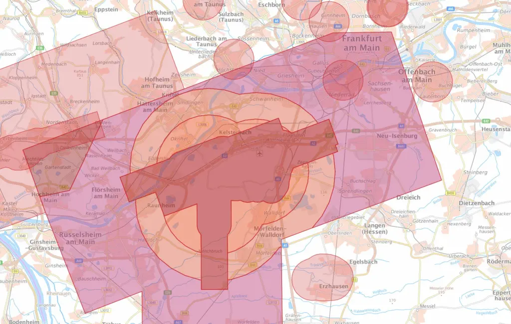
Around the major airports there is a control zone that often extends many kilometers into the surrounding area. At Frankfurt Airport it reaches across Sachsenhausen, Neu-Isenburg and Rüsselsheim. Anyone who wants to take off from a friend’s garden there is right in the middle of controlled airspace.
Since August 6, 2026, a new general ruling from the German air navigation service provider (Deutsche Flugsicherung, DFS, NfL 2026-1-3960) has applied. It covers the control zones of 15 airports, including Berlin Brandenburg, Frankfurt, Hamburg, Munich and Stuttgart, and divides them into an inner area (Zone 1) and an outer area (Zones 2 to 4). Outside, clearance is deemed granted as long as you stay below fixed altitudes: 25 meters in Zone 2, 45 meters in Zone 3. In Zone 4 it is 100 meters above aerodrome elevation or 50 meters above ground, whichever is higher.
It still doesn’t come without conditions. Ground visibility must be at least 800 meters, the drone may not fly autonomously, and you give way to manned aircraft. In the inner area, every flight needs individual clearance from the responsible aerodrome control unit. According to DFS, processing usually takes 14 calendar days, and there is no entitlement to approval.
Six maps and apps compared
Two tables, because the question has two parts. The first says who is behind each tool and what you need to use it. The second shows what the tool knows. The information comes from the providers, as of November 2026.
| Tool | Provider | Cost | Platform | Account required |
|---|---|---|---|---|
| dipul Map Tool | German Federal Ministry of Transport, operated by DFS | free | Browser | no |
| Droniq TraX | Droniq (DFS and Telekom) | basic features free, air traffic picture by subscription | iOS, Android, browser | no, limited without an account |
| DJI Fly with FlySafe | DJI | included in the app | iOS, Android; map also in the browser | DJI account for unlocks |
| UAV Forecast | Matthew Lloyd | free, extra features by subscription | iOS, browser | not specified |
| Austro Control Dronespace | Austro Control (Austria) | free | iOS, Android, browser | for registration and flight plan |
| FOCA drone map | Federal Office of Civil Aviation (Switzerland) | free | Browser | no |
| Tool | Official data | Geozones in Germany | Air traffic, NOTAM | Weather | Permit, registration |
|---|---|---|---|---|---|
| dipul Map Tool | yes | all zones under Section 21h LuftVO | temporary restrictions and NOTAM areas as a layer, no live air traffic | yes, German Weather Service, up to 250 m above ground | links to the LBA, state authorities and DFS application |
| Droniq TraX | no, provider’s own database | yes, „Can I fly here?“ query | live air traffic by subscription, NOTAM in preparation | yes | make your own flight area visible („Fly now“) |
| DJI Fly with FlySafe | no, advisory according to DJI | DJI’s own zones | no | not specified | unlocking DJI zones, no official permit |
| UAV Forecast | no | no-fly zones without stating country or source | no | yes, wind and gusts at altitude, Kp index, satellites | no |
| Austro Control Dronespace | yes, for Austria | no | clearances in control zones | not specified | registration, flight plan, clearance |
| FOCA drone map | yes, for Switzerland | no | daily DABS bulletin separately | no | responsible body for each zone |
None of the providers clearly states whether their app works offline. So count on needing mobile data at the takeoff spot, or check the location the evening before.
dipul Map Tool: clunky, but the reference
The Map Tool runs in the browser, without registration. You search for a place or click on the map, and next to it all the zones that apply at that spot appear, with their type, legal basis and altitude information. In control zones it names the zone and the altitude above which individual clearance is needed.
The „Overlapping geographical zones“ function is helpful for planning. You draw a point, a circle, a polygon or a corridor, or import a GPX, KML or GeoJSON file, and the tool lists every zone that reaches into it. The area is limited to 100 square kilometers, a circle to a 10-kilometer radius. That’s more than enough for hobby flights.
The weather comes from the German Weather Service (Deutscher Wetterdienst). The ICON-D2 model computes on a 2-kilometer grid and is updated every three hours; from it, dipul shows wind, temperature, rain, snow, clouds and humidity up to 250 meters above ground for the next 24 hours. Temporary restrictions appear as a separate layer on the map and also as a list on dipul.de. In mid-November 2026, entries there included police operations in Berlin and Munich.
None of this is convenient. On a phone, the map quickly becomes fiddly; in its accessibility statement, the ministry itself admits that adaptation to small screens does not work flawlessly. And even the official map is no carte blanche. According to the disclaimer, the zones under Section 21h apply even if they are not drawn in. The traffic accident the fire department is attending right now doesn’t show up on any map.
Droniq TraX: the quick look on your phone
Droniq is 51 percent owned by the German air navigation service provider DFS and 49 percent by Telekom. The company’s former app Droniq Maps has been called TraX since May 2026 and runs on iPhone, Android and in the browser. At its core is the question „Can I fly here?“: choose a location, see the geozones, plus weather, model airfields and the flight areas of other pilots who are currently active. With „Fly now“, you make your own area visible to others.
The basic features cost nothing and also work, with limitations, without an account. A name and email address are enough for an account. According to the app description, the live air traffic picture with nearby helicopters and aircraft is only available in the TraX Plus and Pro subscriptions, and NOTAM data was still in preparation according to the release notes. If you’re coming from Droniq Maps, you create a new account. The old logins were deleted as of July 31, 2026.
Our verdict based on the provider’s information: for a look at the takeoff spot, TraX is far more pleasant than the Map Tool. But it remains a private service. Where the app and dipul say different things, dipul applies.
DJI Fly and FlySafe: a warning light, not a permit
If you fly a DJI drone, you already have geozones on your screen. DJI maintains its own database for this, called FlySafe. Since January 2024, the manufacturer has gradually switched it over in Europe to the national zone maps, with Germany among the first along with Belgium and France. Depending on the zone type, the app only shows a notice, requires a confirmation, or requires an unlock with a verified DJI account; in restricted zones the drone won’t take off.
The decisive sentence comes from DJI itself. FlySafe data is advisory and does not replace the official airspace data of national authorities. Two typical misconceptions follow from this.
First: no warning does not mean permitted. Whether there’s a nature reserve, a railway line or a residential property beneath you is governed by the LuftVO, not by the manufacturer. Second: an unlock in the app is not a permit. In the control zone you need clearance from air traffic control; next to the hospital, the operator’s consent. What DJI unlocks plays no role in this.
Before an outing it therefore pays to check twice. FlySafe as a safety net in flight, dipul as the basis for the decision.
UAV Forecast: the weather that matters to drones
UAV Forecast is not a zone tool. It’s a weather forecast for drone pilots. The app shows wind and gusts at ground level and at flight altitude, the number of visible GPS, Galileo and GLONASS satellites, and the Kp index. On a scale from 0 to 9, the index describes how disturbed the Earth’s magnetic field is; from 5, the U.S. weather agency NOAA speaks of a geomagnetic storm. During strong storms, according to NOAA, satellite positioning can be off by dozens of meters. For a drone that holds its position via GPS, that’s no minor detail.
The basic version is free; further features come with a subscription. The app is offered for iPhone and in the browser. In the Google Play Store, several apps with similar-sounding names from other providers show up, so check the developer there. The built-in no-fly zones state neither country nor data source. For Germany they are therefore useful as an add-on at most.
And Aloft? The name comes up often in forums. Aloft is a U.S. service built around clearances from the U.S. Federal Aviation Administration (FAA) and the agency’s B4UFLY app. It doesn’t help with German geozones.
How we would do it
Official first, convenient second. That isn’t pedantry; it’s the only order that holds up when it matters. If you have to explain after an incident why you flew there, pointing to a private app won’t get you far.
- Planning the evening before: dipul Map Tool on the computer, draw the flight area as a circle, check overlaps, note the altitudes.
- At the takeoff spot: Droniq TraX for a quick look and the temporary restrictions. If something unexpected shows up, go back to dipul.
- In the air: DJI Fly warns you but doesn’t replace checking.
- Weather: dipul’s weather layer or UAV Forecast, above all wind at flight altitude and the Kp index.
- On vacation: the map of the respective country, Dronespace for Austria, the FOCA map for Switzerland.
Two minutes before takeoff
- Mark the takeoff spot in dipul or TraX and draw the radius you actually intend to fly.
- Tap every colored area. What is it, what condition comes with it, is there an altitude limit?
- Check temporary zones: police operation, major event, NOTAM.
- If the location is in a control zone, note the zone and altitude and stay below it.
- Look around with your own eyes. Residential properties, railway line, federal highway, swimming spot, people. Not everything is on every map.
- Check wind at flight altitude and the Kp index. If the gusts are close to the limit the manufacturer specifies for your drone, it stays on the ground.
- e-ID on the drone, proof of competency and insurance confirmation with you? If you fly with goggles, an observer stands next to you.
On vacation: which map applies where
The good news first. According to the EU Aviation Safety Agency EASA, your German e-ID and the EU proof of competency are valid in all EASA states, Switzerland included. The geozones, however, remain a matter for each country. dipul links to the official maps of neighboring countries; for vacationers, these are the most important:
- Austria: Austro Control Dronespace, free as an app for iPhone and Android and as an online map. The Quick Check shows whether a flight needs no authorization or requires an authorization or clearance. Flight plans and clearances for control zones are handled directly in the app.
- Switzerland: the drone map of the Federal Office of Civil Aviation (FOCA, German: BAZL) on map.geo.admin.ch with national and cantonal restrictions. Clicking on a zone shows who grants authorization. Before every flight, add the daily DABS airspace bulletin; the edition for the next day is published at 4 p.m.
- Italy: d-flight, the platform for the rules of the civil aviation authority ENAC. The map summarizes the rules for airspace below 120 meters and can only be viewed after signing up with an email address.
- Spain: the ENAIRE Drones map service of the Spanish air navigation service provider.
- France: the map of restrictions for the open category and model flying in the government map portal (Géoportail).
Outside the EASA states, in the United Kingdom for example, only that country’s law applies. Then it’s worth checking the website of the local aviation authority before the drone goes into your suitcase.
Drones for beginners and for pros
If you’re still looking for the right drone, look at the EU class first. It determines whether a course is required and how much distance from people and residential areas applies. The selection comes from the range of our partner Coolblue; the manufacturers state weight and class. You’ll find the detailed comparison of the bundles in our DJI drone comparison (in German), and models with goggles in the guide FPV drones for beginners.
| Model | Takeoff weight according to manufacturer | EU class | What you need | Who it’s for |
|---|---|---|---|---|
| DJI Mini 5 Pro Fly More Combo (RC-N3) | approx. 249.9 g ± 4 g | C0 with standard battery | Registration | Travel and landscape without a mandatory course |
| DJI Mini 4 Pro Fly More Combo (DJI RC 2) | under 249 g | C0 | Registration | Getting started with a screen in the remote controller |
| DJI Air 3S Fly More Combo (RC-N3) | 724 g | C1 | Registration, A1/A3 | Two cameras, longer flight time |
| DJI Mavic 4 Pro (DJI RC 2) | approx. 1,063 g | C2 | Registration, A1/A3, A2 close to people | Commissions and the highest image standards |
| DJI Avata 2 Fly More Combo | approx. 377 g | C1 | Registration, A1/A3, observer | FPV with one-tap acrobatics |
| DJI Avata 360 Motion Fly More Combo | approx. 455 g | C1 | Registration, A1/A3, observer | 360-degree video from a first-person view |
| Antigravity A1 Standard Bundle | 249 g with standard battery | C0, C1 with large battery | Registration, observer | 360-degree video with goggles |
DJI Mini 5 Pro: large sensor, just under the limit
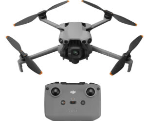
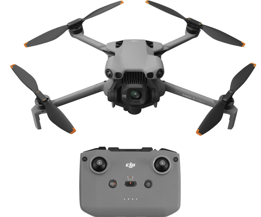
A 1-inch sensor with 50 MP in the 250-gram class, and according to DJI up to 36 minutes of flight time. DJI states around 249.9 g with a tolerance of ±4 g. The drone in the Fly More Combo is certified as C0; with the Plus battery, the same drone no longer flies as C0. So if you don’t want to take a course, stick with the standard battery.
DJI Mini 4 Pro: the predecessor as the budget option
Under 249 g and C0, with a 1/1.3-inch sensor (48 MP) and, according to DJI, 34 minutes of flight time. In the bundle with the DJI RC 2 remote controller, the screen is already built into the controller.
DJI Air 3S: from here on, with a course
724 g, class C1, a wide-angle camera with a 1-inch sensor plus a telephoto camera, and according to DJI up to 45 minutes in the air. The A1/A3 certificate is mandatory, and you may not fly over uninvolved people.
DJI Mavic 4 Pro: C2, and therefore a question of license
Around 1,063 g, a main camera with a 4/3-inch sensor and 100 MP, and up to 51 minutes of flight time according to DJI. You may only fly close to uninvolved people (30 meters, 5 meters in low-speed mode) with the A2 certificate. Without A2, you’re left with subcategory A3 and its 150-meter distance from residential and commercial areas, which rules out many beautiful subjects.
DJI Avata 2: FPV with an observer
Approx. 377 g, C1, 1/1.3-inch sensor, and according to DJI around 23 minutes of flight time. If you fly with goggles, EASA rules require a second person right next to you who follows the drone with their own eyes.
DJI Avata 360: film everything around you, edit later
Approx. 455 g and C1, two 1/1.1-inch sensors for 360-degree video. The Motion bundle includes the Goggles N3 and RC Motion 3; the obligations are the same as for the Avata 2.
Antigravity A1: the 360-degree drone under 250 grams
Antigravity states 249 g with the standard battery (C0) and 291 g with the large battery (C1). It films all around in up to 8K and is controlled with Vision Goggles and a grip. So here too: bring an observer, even though no course is required.
Frequently asked questions
Where can I see whether I'm allowed to fly my drone?
In the Map Tool of dipul, the Digital Platform for Unmanned Aviation of the German Federal Ministry of Transport. Free of charge and without registration, it shows all geographical zones under Section 21h LuftVO, such as airports, control zones, nature reserves, railway lines and residential properties, plus temporary restrictions. Apps such as Droniq TraX present the topic more conveniently, but dipul remains the binding source.
Is the map in the DJI app binding?
No. DJI itself states that FlySafe data is advisory only and does not replace official airspace data. So no warning does not mean permitted, and an unlock in the app is not an official permit. In a control zone you still need clearance from air traffic control.
Which drone app is free?
The dipul Map Tool, the basic features of Droniq TraX, the geozones in DJI Fly, the basic version of UAV Forecast, as well as Austro Control Dronespace for Austria and the FOCA drone map for Switzerland. With TraX, the live air traffic picture requires a subscription; with UAV Forecast, additional features do.
How high can I fly a drone?
In the open category, a maximum of 120 meters above ground. In control zones, lower limits apply in the outer area: 25 meters in Zone 2, 45 meters in Zone 3, and in Zone 4, 100 meters above aerodrome elevation or 50 meters above ground, whichever is higher. Above that, you need individual clearance.
Can I fly near an airport?
Within 1,000 meters and along the runway centerlines extended by 5 kilometers, only in the specific category, so not as a hobby pilot. Farther out there is usually a control zone. Since August 6, 2026, a general clearance from DFS has applied in its outer area below fixed altitudes and subject to conditions; in the inner area, every flight needs individual clearance.
Can I fly a drone over residential areas?
Over other people's residential properties with a camera drone only if the owners or residents expressly agree. In subcategory A3, you must also keep 150 meters away from residential, commercial, industrial and recreational areas.
Can I fly a drone in a nature reserve?
For recreational flights only with the consent of the responsible nature conservation authority, unless state law provides otherwise. The same applies over national parks. The areas are marked in the dipul Map Tool.
Do I have to register a drone under 250 grams?
Yes, as soon as it carries a camera or a microphone. Registering with the German Federal Aviation Office (LBA) gives you an e-ID for all your drones. Under 250 grams takeoff mass you don't need a proof of competency, but the A1/A3 certificate is still recommended.
Which map applies on vacation in Austria or Switzerland?
In Austria, the Austro Control Dronespace app and map; in Switzerland, the FOCA drone map on map.geo.admin.ch plus the daily DABS airspace bulletin. According to EASA, a German e-ID and the EU proof of competency are valid in all EASA states.
What does the Kp index mean for drones?
On a scale from 0 to 9, it describes how disturbed the Earth's magnetic field is. From 5, the U.S. weather agency NOAA speaks of a geomagnetic storm; during strong storms, satellite positioning can be off by dozens of meters. Drones that hold their position via GPS can then drift.
Sources
- LuftVO Section 21h: Operation in geographical zones (German law)
- LuftVO Section 21i: Granting of a permit (German law)
- dipul Map Tool
- dipul: Open category
- dipul: Registration and qualification
- dipul: Minimum age and mandatory insurance
- dipul: Applications for entering geographical zones
- dipul: Air traffic control clearance and general ruling NfL 2026-1-3960
- dipul: Aviation weather forecast
- dipul: Overlapping geographical zones and vector data
- dipul: Temporary operating restrictions
- dipul: User notes and disclaimer
- dipul: Geographical zones in Europe
- EASA: Open category
- EASA: Travelling with drones
- DFS: Drone flying
- Droniq: TraX FAQ
- App Store: Droniq TraX
- DJI: GEO system update in Europe
- DJI: FlySafe data is advisory
- DJI FlySafe: Zone types
- App Store: UAV Forecast
- NOAA: Planetary K-index
- NOAA: Space Weather and GPS Systems
- Aloft
- Austro Control: Dronespace app
- FOCA: Geographical flight restrictions
- d-flight: Services
- ENAIRE Drones
- DJI Mini 5 Pro: Specs
- DJI Mini 4 Pro: Specs
- DJI Air 3S: Specs
- DJI Mavic 4 Pro: Specs
- DJI Avata 2: Specs
- DJI Avata 360: Specs
- Antigravity A1: Specs
Where to buy
- DJI Mini 5 Pro Fly More Combo (RC-N3)View at CoolblueAvailable in Germany: Coolblue
- DJI Mini 4 Pro Fly More Combo (DJI RC 2)View at CoolblueAvailable in Germany: Coolblue
- DJI Air 3S Fly More Combo (RC-N3)View at CoolblueAvailable in Germany: Coolblue
- DJI Mavic 4 Pro (DJI RC 2)View at CoolblueAvailable in Germany: Coolblue
- DJI Avata 2 Fly More ComboView at CoolblueAvailable in Germany: Coolblue
- DJI Avata 360 Motion Fly More ComboView at CoolblueAvailable in Germany: Coolblue
- Antigravity A1 Standard BundleView at CoolblueAvailable in Germany: Coolblue